What Would Our World Look Like Without GPS Satellites?​

​​What Would Our World Look Like Without GPS Satellites?​

October 15, 2024
Facebook

Every day, over 12,000 miles above our heads, Global Positioning System (GPS) satellites work silently to keep our lives on track.

Their positioning, navigation and timing (PNT) support helps us get to where we need to go, serves as the backbone for banking, and enhances global farming activities, to name a few. The atomic clocks onboard these satellites also provide critical timing information that keeps our modern, rapidly evolving world operating smoothly. 

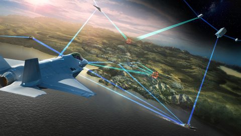
These satellites are not only a necessity for civil operations, but for U.S. military operations as well – providing navigation for all major field assets, as well as critical location information, and supply delivery to troops in the battlefield.  

In the U.S. alone, we use over 900 million GPS receivers – nearly three receivers per person. When initiated, a receiver on our device – like a cellphone for example – then uses signals from at least four GPS satellites to determine our exact location. The time it takes for each signal to reach our receiver helps it discern its position on Earth.

But the current GPS fleet above our heads is already aging, with nearly half of these satellites already operating well beyond their intended design lives. More GPS satellites are needed in space to ensure there is never a gap in the critical capabilities they bring – and Lockheed Martin has more ready to be called up for launch. (You could say their atomic clocks are ticking!)

Cellphone No Signal Icon
Cellphone signals are down, and the internet becomes unreliable, leading to a total communication breakdown. Car accidents pile up on highways, and emergency services are significantly delayed in determining the locations of the accidents, due to the stoppage in automatic tracking for 911 calls. With heavy reliance on navigation applications, map-reading is no longer a common skill, making it challenging for people to get places. We’re also unable to send emails or place phone calls and text messages, rendering us completely disconnected. 
Power Grid Collapse Icon
Power grids collapse. For reliability and security, power systems are connected into large grids with extensive monitor and control systems. Because time stamps from GPS are used for measuring frequency errors in power generation across large areas, GPS is critical for coordination among vast utility networks. With GPS time stamps gone dark, large-scale power fluctuations and outages plague the grid – with no available tools to locate the root cause and resolve it.
ATM Error Icon
Financial insecurity emerges as financial tools and their underlying systems shut down. Financial and purchasing systems utilize GPS timing signals, making it challenging to purchase items with credit cards. Financial instability gradually sets in as the stock market is unable to conduct trading, and people whose retirement funds are locked in the stock market cannot convert those into cash for everyday living. 
Airline Delays Icon
Airline flights and global maritime routes continue to be suspended. Millions of people are stranded away from home, and global business operations are disrupted. A lack of air and maritime freight travel also begins to impact food transport and supply chains across the world.
Farming Icon
Modern mass farming tools no longer properly function. Farming equipment that employs timing and positioning data from GPS satellites to water crops can’t perform their duties, which negatively impacts food production and processing. The trickle-down effect from this ultimately results in an unprecedented global collapse of the farming industry and food supply chains. 
Construction Icon
Ongoing construction projects are paused. GPS information is used by heavy construction equipment for grading purposes on large-scale projects like highways. Unable to accurately shape the land as needed for building projects and city infrastructure, thousands of construction sites indefinitely pause their work. 
Military Signal Loss Icon
Military members continue to have difficulties discerning their field positions and threat locations. These critical activities are called off, undermining intelligence collection and operations integral to maintaining national and global security. 


To ensure this doesn’t become the world we live in, Lockheed Martin is working every day to bring GPS’ next-generation PNT capabilities to bear for our customers – bolstering civilian infrastructure and assuring safety of military operations around the world for years to come.